


Experience Our Overlays
Try it For Yourself
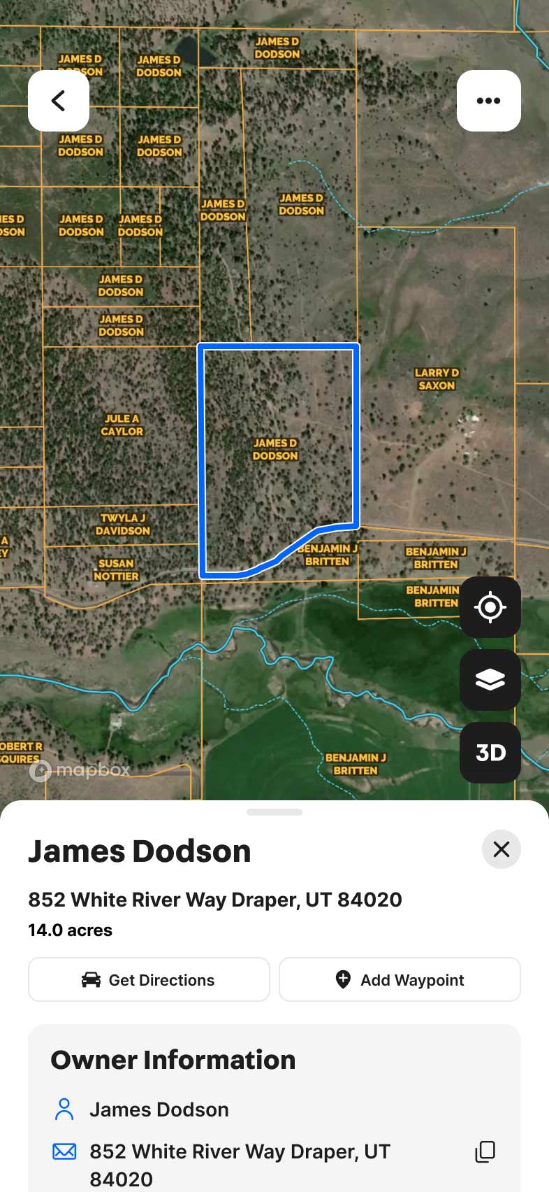
Simply click the Map Legend button to combine and analyze overlays, gain valuable insights into your property, and uncover a deeper understanding of the land beneath your feet.


Explore Private Parcel Data & Property Boundaries
Download the Land id™ app & try the Discover plan for free


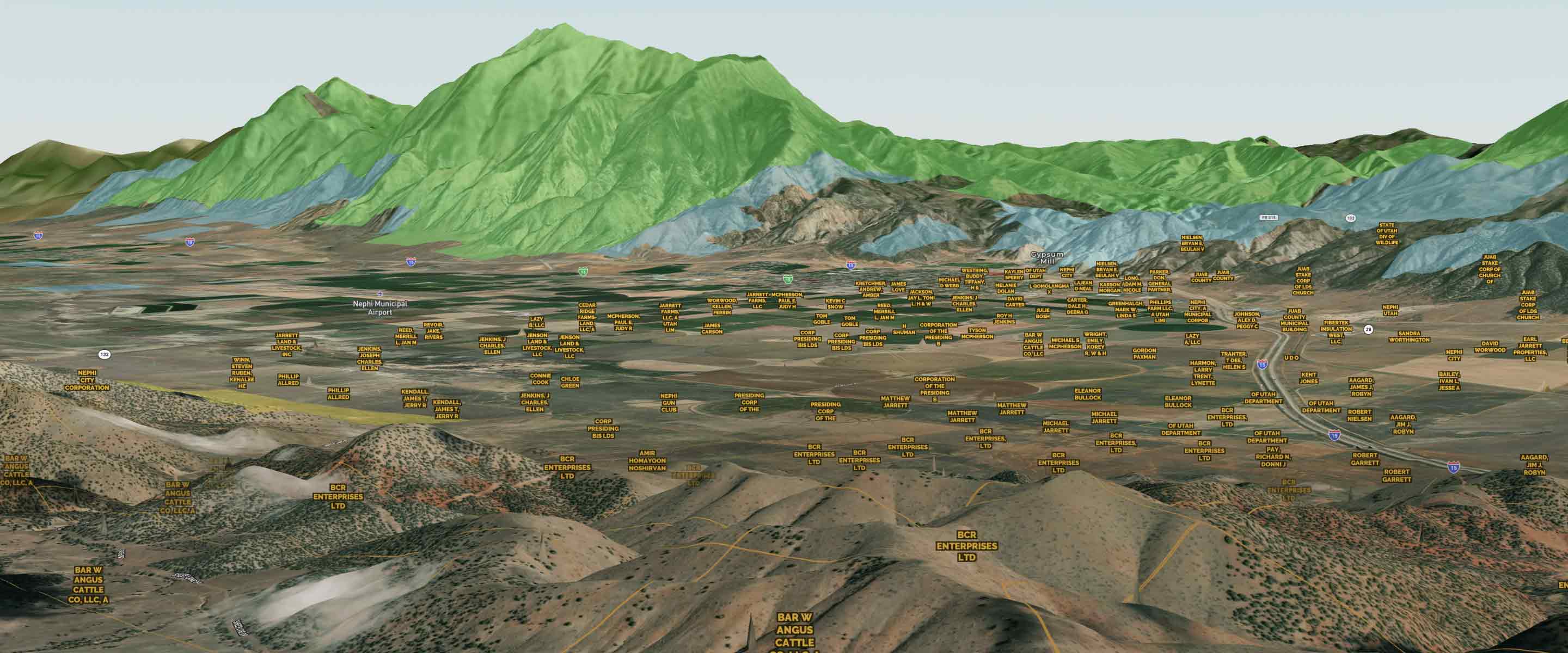
The Foundation for Location-Based Data
Explore Basemaps
Our basemaps are the foundation of your mapping project. With a wide range of basemap styles to choose from, Land id™ can accommodate your specific needs.

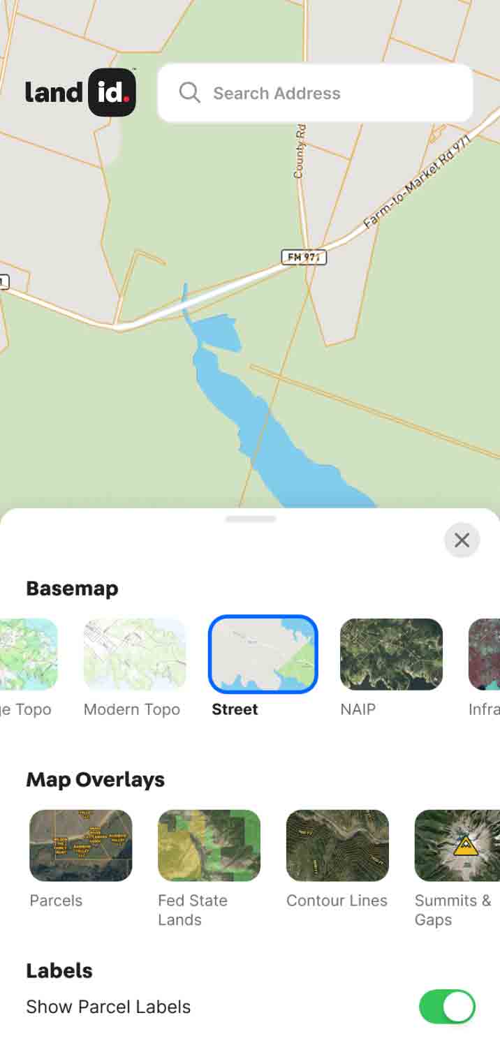
Open Street
This basemap displays roads, streets, and other transportation infrastructure.


NAIP
High-resolution satellite basemap used for agriculture, natural resource management, and urban planning


Infrared
Temperature differences show vegetation health, making it a powerful tool for optimizing land use and environmental monitoring.
Explore Private Parcel Data & Property Boundaries
Download the Land id™ app & try the Discover plan for free
Explore Private Parcel Data & Property Boundaries
Download the Land id™ app & try the Discover plan for free
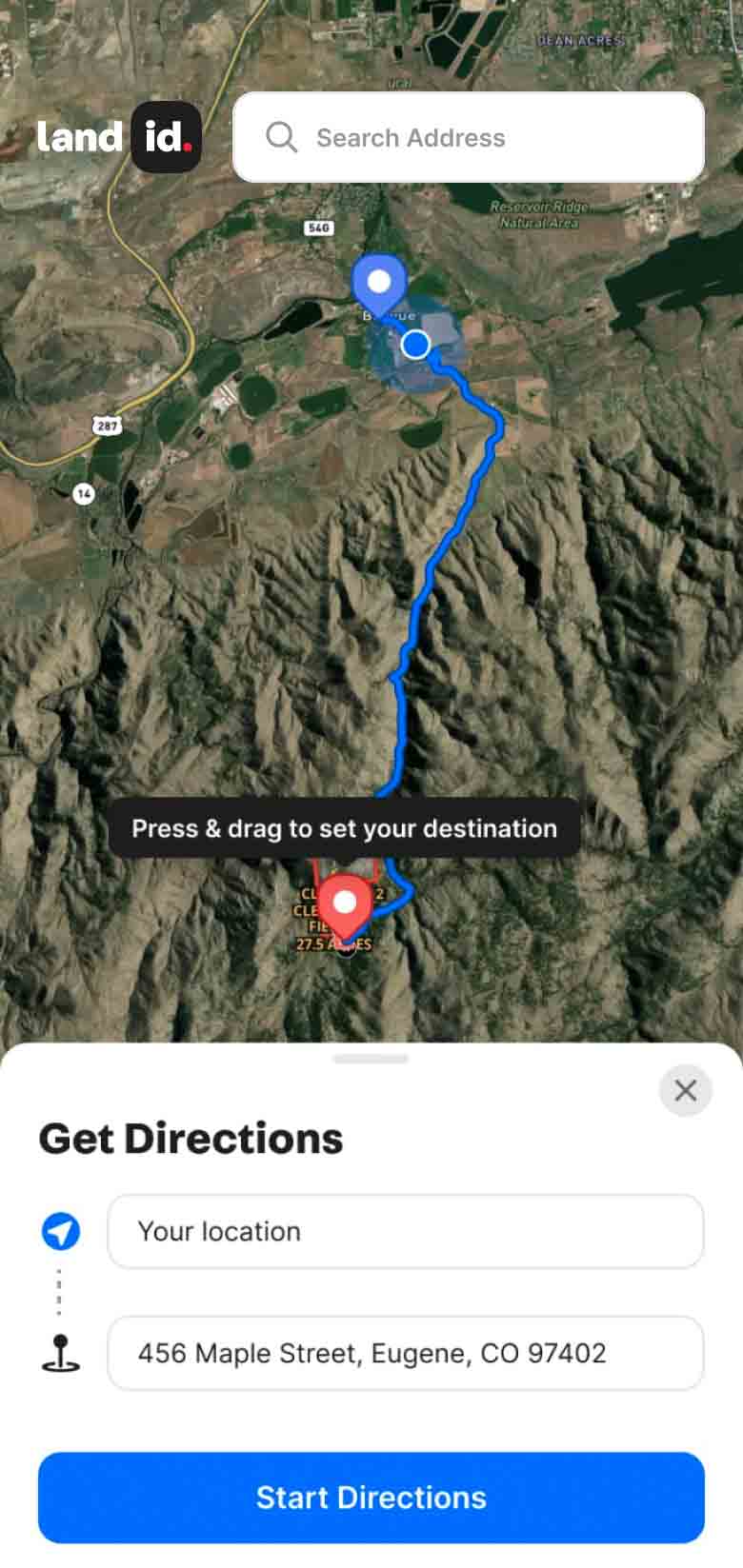
Bring Your Map to Life
Over 40 Map Overlays Nationwide & Counting
Discover your land's potential with our powerful overlays. Combine Land id’s data sources to gain valuable informed insights.


Explore Private Parcel Data & Property Boundaries
Download the Land id™ app & try the Discover plan for free

Demo request received.
Explore Private Parcel Data & Property Boundaries
Download the Land id™ app & try the Discover plan for free
